Hi folks! Haven’t been too many updates of late as there hasn’t been that much worthwhile to update with, but that should be changing as the weather is getting better and some hurdles are behind us. I have taken on caring for a neighbors dog now and again, so that’s new.
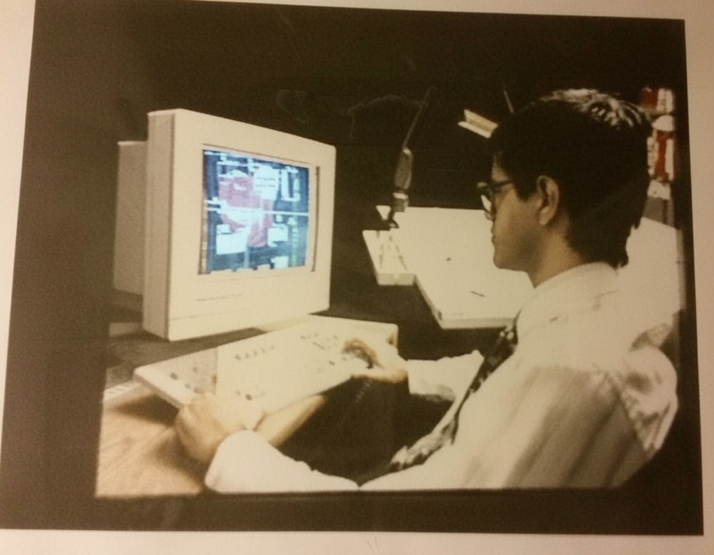
This popped up in my head this morning and I can’t believe it’s been 30 years since this was taken! That’s me sitting at the computer during my days at Arthur D. Little doing AutoCAD work. I believe the image on the screen was the plume of contamination we were investigating at the time over at the Natick Army Labs. This was a promotional shot that the company wanted to do for some marketing or newsletter or some such.
Now that I think about it, ADL had their own photography lab people and would do all this stuff inhouse for their own newsletters that would go out to the employees. Who would ever do that! Of course that was before we got email and all that stuff. Memos would have to be written and printed and then someone from the mailroom would deliver the memo to our mailbox and then we would physically get it and work it out from there. They would reuse the same manila envelope but just cross off the previous office address and we’d write in the next space where we’d want it delivered to next. I had forgotten all this stuff but now it’s flooding back to me.
The white table like thing next to my right was the digitizing tablet. This big piece of tech that basically I could trace over hardcopies to get the images into a digital format that I could manipulate or use later. Generally a geologist would draw out what they needed on the hard copy, I would tape it to the tablet, calibrate the tablet, and then digitize the image they had drawn and get it into the computer. I must have drawn and created thousands of images in my time doing that kind of work. I would then save them as “Layers” which could be turned on and off on the figures to display different things, or to show change over time for instance. A lot of these finished drawings I would then print on a plotter, basically a giant printer. I must have printed thousands of plates that were 44″ x 34″. Then you had to physically cut the drawings to size with a razor and fold the maps to fit into pockets that would go into the reports. Everything was hard copy in those days!